Qhapaq Ñan, The expedition.
Google Earth
Google Earth software needed.
El-Ángel
Laguna Mojanda
Quito
Cuenca
Cajamarca
Cusco
Lac Titicaca
Désert d’Atacama
Salar d’Uyuni
Canyons de Tupiza
Why we decided this expedition!
 It is due to this emergency that we decided to depart on foot in search of this extraordinary road that is on the verge of disappearing. Our expedition aimed to bring this « sleeping giant » for the first time to the public’s eye, and to bring to light the various related issues at stake.
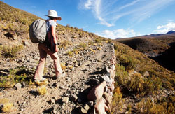
Being the first to walk the integrality of this route, that is only accessible on foot, we utilized the existing scientific research carried out by archeologists, historians and of specialists, such as “el Caminante”, Ricardo Espinosa from Peru. In Bolivia, where the investigation is still ongoing, we took part with a team of experts on the ground in search of the Qhapaq Ñan. A voyage of more than one year and half, on more than 6000 km in extreme conditions, in search of this legendary road.
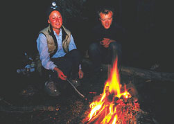
For us, this adventure is the longest journey we could ever have imagined. With no outside logistics (nor tent, sleeping bags, and stove), we were completely dependent upon the hospitality of local communities.
Through the remote areas of the Andes, at times passing through dangerous regions (guerillas, cocaine production, land conflicts, and problems between communities and the mines)
we have tried to address the following questions:
- What remains of this ancient road?
- In what state will we find the archeological sites and ecosystems associated with the road, today?
- What is the relation between the communities and the Qhapaq Ñan? The collective memory, the myths and legends, ancestral traditions – are they conserved?
- In light of the emergency to protect this route (archeological, environmental, cultural), what are today’s solutions? What projects of conservation currently exist along this epic route?


